Friday, December 01, 2006

Death Valley Double Century Attempt: October 2003

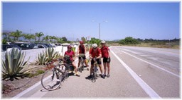
I had a request for a synopsis of the Death Valley Century and Double. There were a few of us from Las Vegas who attended this event. All in all, it appeared that 4 of us attempted the Double and 2 or 3 of us attempted the Century ride. I must say that this was quite a learning experience, especially for those of us going for the California Triple Crown in 2003. Planet Ultra is the main organizer of this event and they put forth a lot of professionalism in their organization. I will focus mainly on the Double since the Century followed basically the same routing.

The event started with a mass start at 0600 for us Double wannabees and 0615 for the Century riders. The weather was superb: Clear skies, no wind, and temperature in the high 40's. As with all rides I've attempted, the atmosphere was energetic and motivating at the start. Mass starts can be fun, but they can also be a bit precarious until the giant peloton thins out. As we pressed South out of Furnace Creek it was fun to see all the "rabbits" take off. I couldn't help but think that it would be difficult for them to keep up that pace for 200 miles, and as it turned out I was right. I saw the vast majority of them again at most of the rest stops along the way.

If you haven't been to Death Valley, I highly suggest a visit. It is the closest experience you will have to being on Mars or the Moon. Cruising along the relatively flat road en route to Badwater, the sun started peaking over the mountains providing us with a great picturesque view of the peaks to the West. Stepheny, Ed and I were lucky enough to tag onto a large peloton with a tandem at the helm. It was great being sucked along at 25 to 30 miles an hour with a heart rate in zone 2! That wasn't to last, however. I've always said that if you loose the Tandem draft, you won't get it back! At least not at a cost. Ed decided to pull over at Badwater so we dropped off the peloton with him only to realize that he then decided not to stop! His decision to continue was more timely than ours, however. Fast Eddy managed to regain the draft, but Step and I lost out and ended watching the train go off in the distance. The experience reminded me of those old Western movies seeing the cowboy sitting on his horse watching the train go off in the distance. The only difference was that we wanted to be on the train and we had to peddle our horses!

Anyway, Steph and I worked together on our way to Ashford Mills, the 2nd rest stop at about 45 miles. Once off the back, I couldn't help notice how quiet the desert was with no one else around. It is almost an eerie feeling, especially after living in noisy Vegas all this time. About 10 miles out of Ashford Mills, the Bullshifters from Phoenix caught us and we hopped on the back of their peloton. (I'd like to digress here abit and discuss teamwork. During this whole experience, I noticed that this club worked together the entire time. There were about 15 of these guys/gals and they all stayed together, sharing the draft and encouraging each other the entire 200 miles. It was quite impressive to see the same jerseys, arm warmers, and obvious teamwork going on here. Watching them really drove home the fact that cycling, especially in these types of endurance events as well as others, is truly a team sport).

Oh well, back to the route. If you haven't seen the middle of no where, I suggest you take a trip to Ashford Mills, especially by bicycle! It fits the definition in its truest form. The largest building I saw out there was the modern day outhouse built by your friendly park rangers. And not to be out done, the tallest bit of vegetation might be the scarce sagebrush scattered randomly across the ground. Nonetheless, we were greeted by cheerful Planet Ultra volunteers dressed up as a "stinger bee" and a "goblin." Given the season, I guess they wanted to get into the spirit of things.

At this point, I remembered my reading from Ed Pavelka's book, "Nutrition for Cyclists." A quick ONE word synopsis of the book is: EAT! So, that is exactly what we did, EAT! What I didn't know was the PB&J sandwich I was eating would be the first of about 10 I would consume throughout the day. Tanked, fueled and still motivated we started the arduous climb up to Jubilee Pass. This is about the point when the peeling of clothes took place. The sun was starting to climb high in the sky and warm the air all around us. I must say that this part of the climb wasn't too bad. The grade was reasonable and the perceived distance did not appear to be too bad either. That was to change, however. One thing about climbing. You don't really pay attention to how bad the road conditions are as you roll slowly over them at 8-10 mph. More on that later during the descent. As with most climbing, riders seem to seek out those with the same ability. I slowly pulled away from Steph and decided to meet her at Jubilee Pass, 10 miles up at about 1400 feet and the Century riders turn around. Again, if you haven't done this ride, I'd take a look at the elevation map: http://www.planetultra.com/deathvalley/dvdcroute.html The map is pretty accurate and will provide a good feeling for the 2nd (and most fun...NOT!) part, of the ride: The grind to Salisbury Pass, as I came to know it. This was a true and seemingly never-ending grind. It made Potosi seem like a speed bump. The thought kept creeping into my cranium that I still had well over 100 miles to go! About 150 to be accurate. Anyway, where there is a road that goes up, there is a road that goes down. Upon arriving at Salisbury, I paused to catch my breath, rehydrate and look for Steph somewhere back over my shoulder. The view from this point is really pretty spectacular. I was amazed at the vastness of this valley and beauty that it oddly bestows. What caught my immediate attention, however, and jerked me back to reality was seeing the endless winding road in front of me. That was it, just road! Where was Shoshone I thought? Surely it has to be down there someplace. I squinted for better vision and scanned the horizon looking for a hint of civilization, but all I could see was what looked like the Great Wall of China heading off towards Tibet someplace. Undaunted however, I pulled up the arm warmers to preserve a little body heat for the long descent and pressed on my way. By this time, Fast Eddy had flown off the front with the speedsters and Steph, unbeknownst to me, was battling a bum knee behind me. So, I was someplace in the middle and all by myself (a bad thing on a Double Century!).

On the long descent, this was about the time you see the serious Double contenders returning from the turn around point at Shoshone. Believe it or not the first of pack was a tandem, a very fast tandem indeed. As it turnout, these folks won the Double in just over 10 hours, if there is such a thing as winning a Double. Anyway, I saw Greg Sciabinca cruising up the hill back towards Salisbury shortly followed by Fast Eddy mashing big gears and conquering Death Valley all by his lonesome. I managed to tag up with a nice tall gentlemen on a vintage Bianchi who graciously pulled me the rest of the way into Shoshone. A realization came over me at this point: Always find out where the lunch stop is! To my grand disappointment, it wasn't at Shoshone. After 2 hours and 20 miles of climbing, you get mighty hungry. So, I downed two more PB&Js, a couple of bananas, followed by a few powerbar pieces. One thing I noticed and thought peculiar was the ever present bottles of Ibuprophen, E-caps, and this and that type pills. I thought, "why would they have all that stuff around." I soon found out why. More on that later.

Getting anxious to start again, I hopped on my steed only to see Steph cruising towards Shoshone. I quickly turned around to join her, because we made a pact in the beginning to finish this thing together. As we talked, she told me she was having knee problems and that I should press on without her. At this point, I was sure she was done and would SAG back. Wrong...as I found out later on both counts. The climb back to Salisbury Pass was a heck of a lot harder than it seemed from Death Valley up. I thought that 1600 feet of climbing would be easier than 3600 ft of climbing but as it turned out I had not ridden 80+ miles earlier. Again, I ended up alone and by myself on this climb. Another bad thing on a Double. On the upside, I had some great conversations with sage bushes who mocked me all the way up; and, I even told God how I felt a few times about his magnificent creations. Although I was feeling pretty good and marveling at my accomplishment thus far, I started to develop a throbbing headache. Not really a bad one, but just that kind of nagging headache that doesn't want to go away. I found out later that it was probably caused by caffeine withdrawal. A good reason not to change your morning habits before an endurance event like a Double if you can avoid it. I decided at this point to just put my head down and grind up the rest of the way while at the same time looking forward to a very long down hill run. A side note: I don't know if it is just me, but do they jack up the grade on purpose just before the summit of these climbs? I don't know, maybe it was just my imagination. Nevertheless, Salisbury Pass conquered for the second time filled me with a great sense of accomplishment. I looked over my shoulder at the "Great Wall" fading away from me and felt very good that I would not be seeing that again anytime soon.

It appears that the Forest Service doesn't spend too much money on their roads in Death Valley. The descent that I thought would be effortless and enjoyable turned out to be somewhat different. I guess the extreme Summer temperatures take their toll on the asphalt in this part of the country. I spent the better part of 30 minutes and 3600 feet of descending dodging pot holes, cracks, and gravel. The relentless bouncing caused by the uneven road did not do much for my headache as well. The road conditions didn't seem to bother some people, however. A tandem with the same tall gentlemen on the Bianchi in tow came wizzing by me at about 50 miles an hour. I did not see them again until the 100 mile mark at Ashford Wells. The same cheerful volunteers in costume met us once again supplying nourishment and providing moral support. It was here that I learned about those E-caps. I saw one guy take literally a handful and choke them down with a large swig from his water bottle. The "killer bee" dude told me that endurance riders take these to replace electrolytes. I also witnessed riders taking handfuls of Ibuprophen and choking them down as well. A SAG vehicle stopped by just before I was getting ready to leave and I was hoping to see that Steph was among the passengers. As the vehicle parked, I saw two guys get out and kind of wonder around in the brush. It looked to me that they had some serious "bonk" on their hands and were definitely done for the day. As I looked at them, I realized that I still had another 100 miles to go and was determined not to look like that...I ate yet another PB&J just to make sure.

Like I said, the forest service doesn't seem to spend much on their roads, especially in and around Ashford Mills. I can't think of a better way to describe the road in this area in any other way other than to say it sucked! Cracks, potholes, gravel, rocks, you name it. After about an hour of this jarring and induced double vision, I realized my cranium ache was not going to go away and I doubted that I would finish the ride. You see, the organizers conveniently made the 150 mark the same as the start point, a very tempting respite indeed.

The sun at this time of day starts working its way down on the other side of the mountains and the temperature starts to drop a bit. I was lucky to cruise up on two guys from the Sacramento Wheelmen, Steve and Bill. I kindly asked if I could get on their wheel and they in turn graciously granted me permission. Our little peloton was just what the doctor ordered. My headache seemed to subside abit and watching the back of someone else's wheel seemed to make the miles flow by faster. Steve and Bill informed me that lunch was at Badwater, about 23 miles down the road. That motivation kept me going as the thought of another PB&J sat heavy on my mind. Steve and Bill were Double veterans. I couldn't help but notice their smooth pedaling and exact pace. These guys road at exactly the same speed for what seemed like hours. I was truly impressed and greatly appreciative of the pull. At this point I did not even care what the mileage readout was. All I wanted was food and a place to take a break. We basically blasted through the Century barrier with barely a notice. About an hour and a half later we turned the corner into Badwater for what was my next final stop of the day. After 123 miles it is amazing how good a turkey and cheese sandwich tastes with a sugar laden cola. Steve and Bill tried to convince me at this point that I should keep going for the whole 200, but I wasn't all that comfortable making the decision at this point. I told them that this was my first attempt and that my headache was going to be the deciding factor.

Leaving Badwater the sun started to drop lower and lower behind the mountains. We donned our clear lenses and mounted our lights. I'll say this for lights. If you have one of those rear ones that flash red, don't turn it to flash with someone riding close behind you. I watched Steve's "two" red lights flash alternately for well over an hour. If you have even the slightest headache, watching those things for an hour will make you want to puke! I felt somewhat guilty about sucking their wheel for so long so I decided to pull my weight for a change and get out front. As it turned out, we captured a group that blew past us earlier and road their wheel for about 5 miles or so. The great thing about a Double is that it brings home the Tortoise and Hare story. The three of us basically caught all of those who blew past us earlier...a great feeling especially after a long day of riding!

For me at least, it was a great thing seeing the lights of Furnace Creek in the distance. As things turned out, I finished 150 miles in 9 hours and 47 minutes of riding time. I took 1 hour worth of breaks to refuel and hydrate, just what I had planned. All in all, it was a great experience and one I will definitely learn from. Here are a few lessons learned.

1. Most importantly, find a riding partner. 200 miles is longer than you think!
2. Eat and drink constantly. I burned 5775 Calories in just 150 miles.
3. Train more than you think you need to, especially on long climbs.
4. Don't cut up your powerbars. They fuse together into one big dog turd in your bag!
5. Carry a camel back until you can store water like a camel. Constant hydration is key!
6. Use Hammer Gel. It really works. Tastes funky but it is good for the long haul.
7. Keep a sense of humor going and don't think about the finish line until your wheel crosses.
8. Say "thank you" to all volunteers. It is the nice thing to do.
9. Eat a steak and have a beer when you are done. They taste great!
10. Always ask to suck a wheel. It is proper etiquette.
11. Don't ride alone at anytime! It sucks.
12. Don't be in a hurry. After all, you have all day!

Monday, November 27, 2006

Pacific Coast Tour, July 2000


Introduction

Unloading the bikes in Santa Cruz

Ever since we had become tandem enthusiasts, we had always toyed with the idea of a bike trip down the Pacific Coast Highway. Originally, the plan was to ride from someplace North of San Francisco and end up in Santa Barbara. That idea got the kibosh when we realized the time and distances involved exceeded our vacation availability. So, we settled on a route from Santa Cruz to Santa Barbara instead. With that plan in mind, I set out on my cyber-surfing adventure to see if anyone had done this type of trip before. I was sorely disappointed that not only had our “Lewis and Clark” adventure been done before, there was even a book written about it. In fact, the folks that wrote the book, rode and documented a route from the Northern border of the United States to the Southern border, mostly along Hwy 1.
The start of our jouney between Sana Cruz and Monterey

Lessons learned.

First off, I think it is probably a good idea to put the lessons learned up front instead of leaving them until the end of this article. First, and most important: bring twice as much money and half as many clothes. My Dad used to say that all the time when I was a kid getting ready for the family vacation. He was right and we keep relearning that lesson over and over on just about every trip we take. I can say that we definitely packed way too much for our trip. The BoB was bursting at the seams. If you think about it, you spend most of the day in your riding gear and very little time in the other clothes you bring along. The riding gear can be washed in the sink or the local laundry facilities at most hotels. I, myself, found that one pair of all around walking shoes was adequate and a light pair of pants to be quite sufficient. Most of the other stuff just stayed in the bag. I would say that the second most important lesson is to scale back your daily mileage. Our average seemed to be about 60 or 70 miles per day with one day into Lompoc set at 110 miles with the last part of that 110 up Harris Grade Road! We will never do that again! 40-50 miles per day allows you to slow the pace down a bit and take in more of the scenery. There is always the unplanned extra picture, water stop, or food breaks along the way that can eat away at your time. Not to mention that the pressure to “get there” is also alleviated with a lighter road schedule. I would also schedule a day off sometime during the middle of the trip to rest and take in some of the local activities. It might even be a good idea to schedule a couple of days off or a few days with really light mileage if you plan on riding several days back to back. We kept the pressure on by riding everyday of the trip and by the time we hit Hwy 101 into Santa Barbara the legs were screaming! It would have been much more fun to end the ride a bit more refreshed instead of being relieved to have just gotten there. Although we did take in most if not all of the scenery, we whipped through Big Sur and cruised right past Hearst Castle, something we all regretted later. After spending time at both just recently, I realized we made a big mistake by being so schedule driven. Lastly, I think panniers are the way to go for a couple of reasons. The BoB is a nice idea but on a Tandem it made the bike hard to handle at lower speeds and proved to be real pain in the butt when trying to find a place to park the bike. It was like trying to maneuver a double-trailer 18-wheeler around. While the Bob is probably OK for a single, I think it is too cumbersome on a Tandem. Panniers would force you to carry only what you need and they offer more flexibility when loading and unloading along the route. All in all, it was a fantastic trip and something we will always remember and cherish. The plan is in the works for another trip, but his time we will definitely incorporate our lessons re-learned!

Bobbie-Looking back north towards Monterey and Carmel

The Preparation.

I took it upon myself to make all the arrangements and plan the route. We used the book, Bicycling the Pacific Coast, Third Edition, by Tom Kirkendall and Vicky Spring. This turned out to be a valuable guide and great source of information. The book is mainly focused on camping along the way so we just modified some of the stops to incorporate our accommodations. As a source for mapping out the route, I used Microsoft’s Streets and Trips 2000 version. I traced the route day by day to come up with the correct mileage. Going a bit overboard, I made daily ride chits and maps using screen captures and printouts from the program. This turnout OK, but again it was a bit overboard as we did not need the level of detail I provided. The detailed maps did however help us key in on a few lunch stops along the way that we would not have otherwise been able to notice. As for the accommodations, I started calling for reservations in April for a July trip.
Bobbie enjoying the view to the south

The California coast is in high demand during this period so I figured the earlier we nailed down our digs the better. I would also try to plan for the unexpected surprise like the one that popped up on us in the May time frame. Evidently, strong rains washed out part of Hwy 1 between Carmel and San Simeon. Had Dennis not checked on this, there might have been a possibility that we could have been all dressed up with no place to go. I would check with the CHIP boys every now and then to make sure the roads are clear. The next major logistical problem to solve was how to get the bikes and us to Santa Cruz while leaving our transportation in Santa Barbara. We dropped the airline idea immediately due to the cost. The Amtrak solution seemed viable until we realized that the time spent on the train getting there would eat into our riding time. If you have a couple of weeks to burn, that may be a fun way to go as the train travels along the ocean a good deal of the way. As a result, we decided on a two-pronged attack to get us to the starting point. Dennis was kind enough to come up with the “haul” the bikes plan into Santa Cruz. We rented a Uhaul truck that Dennis and Julia drove from Las Vegas to Santa Cruz. This proved to be a pretty good idea, but 10-12 hours in a Uhaul can be pretty brutal. They recommend weight belts to keep the kidneys in shape!
Bobbie looking back to the north

Our other plan included dropping off two vehicles at the Santa Barbara airport long-term parking lot and renting a car for a one-way trip to Santa Cruz. This worked out well because we got to take advantage of the security provided at the airport and the fact that the rental company did not charge for a one-way drop off. I won’t go into any detail as far as stuff to take with you, but remember lesson learned number one and you would be just fine. I will say this, however. The nights and early mornings along the California coast can get down into the 40°F region, so I would plan accordingly for that one. After all, nobody wants to Tandem with a freezing stoker!
A view to the south and group photo

The Travel Day

It was time to put the plan into motion. I took the Tandem over to Dennis’ place and we loaded everything in the truck for the long drive to Santa Cruz. The next morning came bright and very, very early. The plan was to be on the road heading out towards California by 4 AM! What a brutal get up that turned out to be. Not to be daunted, we rubbed the sleep out of our eyes, poured a few quarts of java into ourselves and off we went. The drive to Santa Barbara isn’t all that exciting unless you like brown scenery with the occasional Joshua tree thrown in for a little contrast. But nevertheless, we kept our thoughts and conversations on the expectations and challenges that lay ahead. It takes about 4-5 hours to get to Hwy 5 for the short spurt over to Valencia and 101 up to Santa Barbara. The drive up 101 is scenic and very pleasing despite the California traffic during the middle of the day. The route to the airport is a little confusing so, if you are planning on replicating our trip, plan ahead and map out your drive ahead of time. The airport is actually a little North of Santa Barbara and just off 101. Our biggest concern was leaving our vehicles in the long-term parking lot. We weren’t sure if there was a limit on the time. As it turned out, that wasn’t an issue. We just got a ticket and ended up paying the maximum fee. We picked up our rental car with no problems and started our drive up to Santa Cruz. The drive along 101 is pleasant and the California inland was a pleasing change after looking at desert landscape for the past 5 hours. We arrived in Santa Cruz at about 5 PM without a hitch and it was good to get out of the car. Dennis, on the other hand, decided to take a somewhat circuitous route and ended up getting a little off track. Once they arrived we unloaded the truck and started the preparation for our long awaited bike trip. We did plan one thing turned out to be a pretty smart idea. We decided that after driving all that way, we would take the next day off and just enjoy the local area. We went for a short bicycle ride through Santa Cruz up the PCH a little way just to work the kinks out from the long drive. As expected, the weather was cool and foggy early in the morning. The views as we cruised up and down the highway took our minds off the weather. Santa Cruz is really a progressive town for cyclists. Motorists just seem to know that bicycles are part of the status quo of transportation. We never really feared for our safety in the city the whole day. We also took a short day trip to the Redwoods, which turned out to be quite an educational experience. I highly recommend this side trip if your itinerary will accommodate an extra excursion.

Day 1, July 3. Santa Cruz to Monterey. 47 Miles.

The gang just outside of 17 mile drive

The long anticipated moment had finally arrived. We wrestled the Tandems down the hotel stairs and started on our way. As expected the temperature was a bit cool and the sea fog had rolled inland over night. I was quite comfortable wearing my arm and knee warmers and a Pearl Izumi vest. The route out of Santa Cruz takes you into some very scenic farmland. You get a nice view of the water from a distance and compared to the desert it is quite a pleasant change of scenery indeed. The terrain is gently rolling with a few rollers thrown in just to keep you honest. I would say the roads were in fair condition. A few sections were pretty bumpy with potholes and old pavement, but you can’t expect smooth sailing all the way when riding through farmland. There is a real nice fruit stand where the route final dumps you out onto the PCH. It’s a good place for a rest stop and some refreshment. The PCH, up to the point were you turn off to Castorville has a nice wide shoulder and is fairly smooth. The winds are generally out of the northwest providing a nice push as you cruise along. The rest of the route takes you through the quaint little town of Castorville. Proceeding through Castorville, you cross over the highway and pickup a bike path that takes you all the way into the Monterey area. The bike path is smooth with a couple of gentle rollers along the route. Once you get into the Monterey area the only viable means of getting from one side of town to the other is to stay on the bike path. You need to exercise some caution because a lot of people use the path for walking, jogging, and rollerblading. We rolled up to our hotel and immediately took advantage of the complimentary hot tub!

Day 2, July 4. Monterey to Big Sur. 46.6 Miles.

Patriotic Stokers!!

The day started with a very nice continental breakfast provided by the Best Western of Monterey staff. As expected the weather was again a bit cool and the fog provided air cover hiding the sun from us. We started our journey a few streets up from Cannery Row and proceeded towards the outskirts town towards 17-mile drive. This section of Monterey is really beautiful. There are several quaint beach homes along Ocean Ave. and you get a beautiful view of Monterey Bay on the initial part of the ride. As you approach the Northwest point of Monterey the road turns to the South and starts to head towards the Pebble Beach area. The road winds and turns through the golf courses and eventually turns up towards the residential areas. Turning into the residential area, you come upon a guard shack where you receive a map and some “don’t go here on your bike” instructions from Ranger Rick and his sidekick Barney Fife. Turns out we went “there” anyway by mistake…more on that later.
Dennis and Julia in another shot along Hiway 1

Anyway, the route through the residential area takes you again along a series of golf links. The area is covered in vegetation and tall pine trees that provide a refreshing canopy while you ride along. On this trip, we saw several deer and a couple of foxes prancing across the fairways. The road takes you back out into the open and proceeds along the endless golf links and then turns abruptly back to the east. This is where we weren’t supposed to be! I could soon understand why. As you turn back to the east, there is a wicked grade staring you in the face…short but wicked, 15% grade at least and very, very, narrow. I had come to find out later, had we followed Ranger Rick’s instructions the climb would have been much less difficult. Proceeding further East towards Carmel, 17-mile drive takes you through the heart of the Pebble Beach complex. This is a really nice area to stop and take a break, fill water bottles, or get something to eat. Mind you, your spandex won’t fit in exactly with the golfing crowd, but they’ll recover. We proceeded out of the Pebble Beach area and cruised through a canopy of beautiful trees that led us into a residential area with some of the largest estate homes I’ve ever seen! Rubbernecking the whole way and pointing at just about every home, we finally made our way to the turn off that leads into Carmel. The turn off 17-mile drive into Carmel is a very steep with several scary switchbacks. I’d advise some serious caution here especially if you plan on carrying a big load. Our routing through Carmel was a bit difficult. 17-mile drive turns into San Antonio Ave that intersects Ocean Ave. We took Ocean which as we found out was not the way to go. The climb on Ocean Avenue is tough; the road is narrow and quite busy with cars. Hindsight dictates that continuing through on San Antonio to 13th Street and taking 13th Street to Hwy 1 would have been a smarter and less strenuous option. Carmel is a beautiful little town and is a great place to stop for lunch. I recommend this because it is a pretty long haul to Big Sur and there aren’t too many places to refuel along the way. By this time, the sky opened up and we were graced with sunshine. The entire ride to Big Sur was like riding in a postcard. As you can see from some of our pictures, the cloud mixed blue sky combined with the rocky coast is breathtaking moment after moment. At this point I would characterize the ride as moderate difficulty. The hills are challenging but not impossible. If we hadn’t had such a large load to drag around, the ride would have been sheer pleasure. I couldn’t help thinking how pleasant it would have been had we had someone to haul all our stuff for us. We ended our day with a nice fast pace under a Redwood canopy into Big Sur. Our accommodations were superb and the feeling of sleeping in the forest made for a very comfortable night’s rest.

Day 3, July 5. Big Sur to San Simeon, 68 Miles.

Dennis at Nepenthe

We awoke on this day to a glorious sunrise peering through the tall redwoods. We decided to cruise down the road and look for a place to eat breakfast instead of eating at a spot near our hotel. This turned out to be a bit of a mistake and I highly recommend fueling up before hitting the road. After helping Bill fix a flat, we encountered a monstrous climb on the outskirts of Big Sur. It wasn’t all that steep, just never ending and laborious. As we peaked over the summit with great relief we decided to stop, take a much-needed drink of water and wait for the rest of our group. As we waited, a very nice lady crossed our path and we decided to ask where we could find a place to eat breakfast. In her broken English, she kept repeating the word Nepenthe, Nepenthe. As it turned out she was right. This was one of those times when you need to reassess your mileage for each leg of your journey.
Relaxing after breakfast at Nepenthe

We could have hung out at this place all day. The food here was absolutely excellent! I recommend the Salmon omelet with a side dish of fruit. Reluctantly, we forced out overstuffed selves up and down and all around Hwy 1 all the while stopping periodically to take in the scenery. This might be a good place to mention traffic. For those of you who think the road is too narrow or that there is too much traffic to ride safely out there, I say you don’t know what you are missing. We found most, if not all, the drivers were very friendly and courteous. The highway twists and turns so much that traffic moves slowly anyway; that alone makes it fairly safe for cyclists. I will admit, however, that there is little if any shoulder so you do have to hog up some of the road for yourselves, but overall, the scenery and experience seriously outweigh the potential dangers. The rest of the ride to San Simeon was just glorious. We got lucky and picked up a 30+ mile per hour tailwind from the Northwest as we came down from the hills into flats leading into San Simeon. This turned out to be a great relief as our tired legs were starting to talk to us.

Day 4, July 6. San Simeon to Lompoc, 110 Miles.

Without a doubt, this turned out to be one of our most challenging days. In hindsight, this is where I would have broken the trip into two 50-mile days or taken the day of rest and visited Hearst Castle. Although our legs were tired the night before, both of us felt pretty rested and ready for the ride. We knew it was going to be a long day so we started our journey at 7 AM sharp. Once again, we were greeted with perfect riding conditions. The first part of the route takes you along the water and then turns inland just after Cambria on through to Cayucos. Cambria is a great little town offering numerous places to stop and have a meal or just take a break from the road. Cayucos offers the same as well.
Bobbie and Julia just north of San Simeon

The route into Cayucos drops you off Hwy 1 on a very scenic ride through the outskirts of town and eventually drops you back on Hwy 1 on the South side of town. Once back on the highway, there is a very nice wide shoulder that leads you past many beaches and into Morro Bay. Once again, Morro Bay offers a great place to stop and take a rest or take in some of the local scenery. Leaving Morro Bay Dennis and Julia were having mechanical difficulties and decided to make a direct route to San Luis to a local bike shop. Our plan was to rendezvous somewhere in Pismo Beach for lunch. The route again turns inland and we ended up on Los Ossos Valley Road heading towards San Luis Obispo. This turned to be great fun as we picked up a “racer dude” on a training ride plus a tailwind.
Dennis and Julia just outside Big Sur

This turned out to be great fun as we made it to San Luis in record time. We skipped most of San Luis on this trip, which we later regretted. I highly recommend taking the extra time to see this town. It is very quaint and has a lot of atmosphere. The route gets a little squirrelly here because there is a road leading out of San Luis that parallels Hwy 101 and if you make a wrong turn you can wind up entering Hwy 101, a bad idea at this juncture. As it turned out we made the correct decision and were rewarded for it. The road was lightly traveled and well paved. A short time later, we entered the Pismo and Grover beach area. This is where we got our first flat and on the rear wheel of all places. Since we lost Dennis and Julia, we figured this would be a great time to let them make up some distance on us. What we didn’t realize, however, was the fact that Bill had meant to ride with us, while we thought he had intended on following Dennis and Julia into San Luis for repairs. He inadvertently got dropped when we picked up a racer dude from Cal Poly so he ended up out in the wilderness by himself. After a few cell phone calls, Bill was found and everything was fine. As the route exits the beach area there is a pretty good climb up to the plateau that leads you into Guadalupe. From here on, the ride transverses through California’s farmland and you get an up close look at all the produce being grown along the sides of the road. Riding over smashed heads of lettuce on a Tandem is great fun!! By this time, we were about 80+ miles into our day and we were starting to feel the toll of too many miles. Then we were faced with what felt like a cruel joke Harris Grade Road: A sadistically long and seemingly never-ending steep climb.
Harris Grade conquered!!!!

I don’t think I can remember when I’ve ridden up and around so many switchbacks. I’ve done The Ride of Rockies at well above 8,000 feet on most days and nothing compared to Harris Grade. Bobbie, my wonderful wife and stoker, was not very happy with my choice of routes. I highly recommend taking the Hwy 1 cut off towards Vandenberg AFB as an alternative route. The ride down the backside of Harris grade into Lompoc was a relief but still a bit dicey. Coming down was almost as difficult as going up when you combine all the switchbacks and steep grade. Nevertheless, we were grateful just to get to our hotel and take a very well deserved hot shower!!

Day 5, July 7. Lompoc to Santa Barbara, 47 Miles.
Getting towards the end or our journey


I can say that I had mixed feelings about this day. On one hand I was relieved we were finishing up the trip, but on the other, I was a little sad we were at the end of a great ride. Nonetheless, we fueled up, did some last minute mechanical tweaking and headed on our way. As was fairly usual, the weather was cool and very cloudy on the first part of our ride. We decided to take Hwy 1 out of Lompoc and join Hwy 101 just before we got to the coast. The first part of the ride was quite pleasant as you are surrounded by beautiful rolling hills and vegetation. Climbing gently into the hills, the weather finally broke and we were greeted by a beautiful sunlit broken sky. Just prior to joining Hwy 101, there is a monstrous downhill with a steep grade. This was the point were we learned about rim heating caused by long periods of braking.
The last of the big climbs is almost over!!

About a quarter of the way down the grade, we blew the rear tire. Luckily it stayed on the rim and we were able to come to a safe stop. Getting slowed down was a bit scary. The Bob acted like a destabilizing device and created a severe wobble at the rear of the tandem. This is a tried and true way to destabilize your stoker. I was able to control the bike, but at times during our somewhat panicked descent I had some doubts whether I’d get the thing slowed enough to make a safe stop. I must say that got our adrenaline pumping enough for one day. Tire repaired and heartbeats back in zone 1, we pressed ahead to a rather uneventful join up with Hwy 101. The route on Hwy 101 is safe and scenic enough, but it pales in comparison to riding along the beach and through the beautiful back country. You wouldn’t think that 47 miles was that far, but after 4 days of climbing and riding a century plus the day before, we were exhausted and out of gas.

The End: Santa Barbara Airport and ready for the hot tub.

We were, however, still glad to be on the bike and enjoyed the scenery the entire ride. You can tell when to exit Hwy 101 because there is a big sign that says, “Bicycles must exit here.” The gentle climb up the exit ramp felt easy knowing that we were just about at the end of our journey. I couldn’t help but think how well we rode the last 320 miles and how much fun it was. The last part of our journey to the airport was mostly downhill through the suburbs of Santa Barbara. The last few miles of the ride were filled with thoughts of soaking in a hot tub and enjoying a cold one. We were hoping the band would be playing and the crowds along the side of the road would be cheering the peloton as we cruised by victorious; but alas, we had to settle for the squawk of the lone seagull sitting on the airport parking lot fence. Try it you’ll like it!

For all the photos of the trip click here.

Here are a few great websites for insight to the pacific coast:

Morro Bay Web Site
More Morro Bay
San Luis Obispo Guide
City of San Luis Obispo
San Luis Visitor Guide
City of Lompoc
More on Lompoc
City of Solvang
County of Santa Barbara
Santa Barbara Airport
Santa Barbara Hotels
Santa Barbara Bicycle Coalition
Santa Barbara Tourism
Bicycling the Pacific Coast
Microsoft’s Streets and Trips
Santa Cruz Web Site
Santa Cruz Boardwalk
Santa Cruz Directory
Everything Monterey
Monterey City Web Site
Go Monterey
Monterey Visitor Guide
17 Mile Drive
17 Mile Drive Scenes
Carmel Resource Guide
Carmel by the Sea
Carmel Information Center
Carmel Tourist Guide
Big Sur Resource Guide
Big Sur On-line
Nepenthe Restaurant
Point Sur Lighthouse
Hearst Castle
San Simeon’s Best
San Simeon On-line
Elephant Seals

Ok, I know it has been quite awhile, my bad!

Well, life seems to suck in a few sort of ways and I guess I let things get a little stale. So, here goes almost a year later. I'm changing this site to my musings about some of my cycling adventures. I'm dedicating this little piece of space to stories of my cycling experiences from competitive (not many) all the way to long-distance riding. I'm not sure how this will turn out, but I think anybody who reads some of these experiences will gleen some form of entertainment and even learn a few things. I dusted of some of my old stories that have seem to have been buried somewhere, someplace in the past few years for anyone's entertainment. This will take me a little while so please bear with me as I get the dust off this keyboard.

Wednesday, November 30, 2005

Flashes from the past ...


Ever start on a project and get so wrapped up in the details that the original project you started morphs into something completely different? Well, that kinda happened to me last week during the Thanksgiving break. I was actually going to clean up the office area that we haven't really moved into yet when I came upon this box of really old pictures of family from days long gone by. As I thumbed through a few of the pictures, the thought of putting them into a photo album jumped into my head and I suddenly forgot all about cleaning the place up. Photo after photo revealed aspects of my life that I had completely forgotten about or never really realized even existed. For example, I came across an old picture of my grandfather and me along with what appears to be several other folks on my grandfather's side of the family. It dawned on me that the only people I recognized were my grandfather and my grandmother. The other folks seemed to be complete strangers. At first, I didn't even recognize my own father until later when I blew the photo up on my computer. What's the point? Well, I thought that it was pretty strange that I don't know anybody in my immediate family beyond my grandmothers and grandfathers. To me, that's a real shame because I'm sure there is a lot of family history and great stories buried in those old photos that will never really be told, or written about. Some of these photos will forever be beautiful diaries of lives and events that are locked away forever. Only the imagination of the prospective viewer can deduce what story the photo really holds. Like I said, I thought this was a real shame, so I embarked on a project of my own to document and unlock the stories behind the photos for which I hold the key. Let the story begin ...

The palest ink is better than the best memory.
Chinese Proverb