Ever get one of those thoughts that you would like to do something different in terms of cycling events? Well, that’s what we thought about our out-of-state cycling excursions. Typically, we have always selected California or Utah as our out-of-state location for cycling. This year we decided to take on Arizona and find a nice ride that suited our needs. GABA (Greater Arizona Bicycling Association) puts on the White Mountain Tour every year in July, and from the description I found on the internet this looked like just the ride we were both looking for: A nice ride through mountains and small towns.

For those unfamiliar, GABA is a group of bicycle clubs throughout the state of Arizona that have banded together to help each other put on cycling events and support each other in their various cycling activities. This is a great organization because each club pitches in to support cycling activities of other member clubs; a unique concept that has apparently been working quite well over the years.
The tour starts at the Hon Dah Resort and Casino located just south of the town of Pinetop and inside the Apache Indian reservation. Pinetop is nestled into the Sitgreaves national forest located in the Northeast corner of the state about 70 miles south of I-40.
Leaving I-40 for the drive down highway 77, one gets to see just what the high plains desert is really about. Actually, the Arizona high desert is quite beautiful as it transitions from a lifeless landscape to thick pine and spruce forest. Pinetop, as in its name, is quaintly situated within the tall pines and leaves you with the impression that the town is smaller than its actual size.
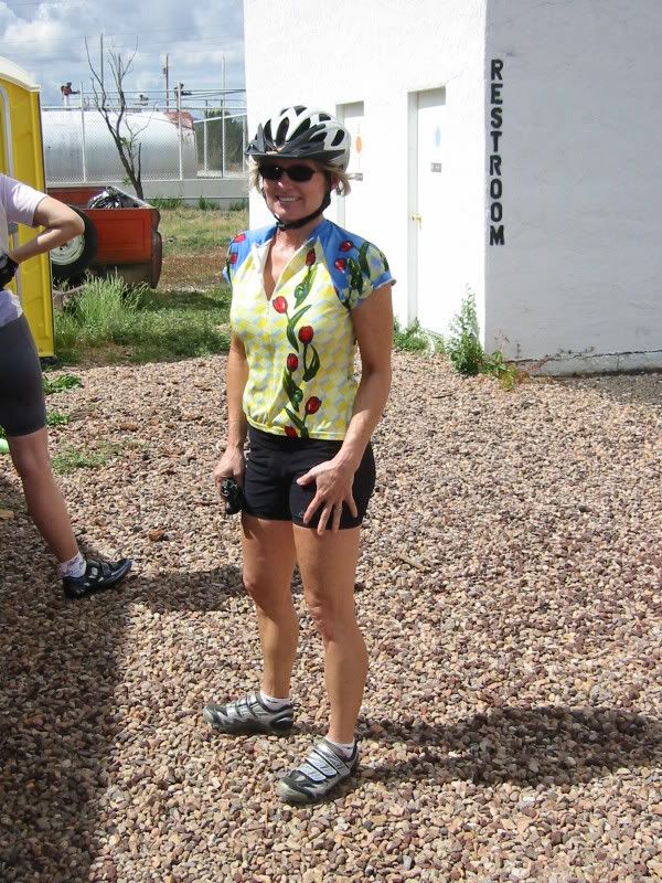
On Saturday morning, the folks from GABA were staged behind the Casino ready for rider check-in and late registration. We signed in, dropped off our overnight bags and got the bikes ready for the tour. What surprised me at this point was how cool the air felt at this altitude. Pinetop sits at about 6000 ft and the temperature ranges from the 60’s during night and early morning hours to the mid 80’s later in the day at this time of year, quite a difference from the hair-blower temperatures we were used to here in Las Vegas.
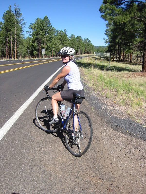
Since this was a tour instead of your basic Century ride, we opted for singles, and I decided to use my commuter bike equipped with a larger pack from Detours and mountain bike pedals. We figured we would need the extra storage space for some emergency rain gear and a few other essentials. This turned out to be a good choice because we eventually needed the extra space to stow the warmer clothes once the temperature reached the 80’s. The mountain bike shoes were also a good choice as we were always walking through gravel to get to the SAG stations along the way.
The first day of the tour takes you on a 67 mile ride from the Hon Dah Casino outside Pinetop to the small co-located towns of Springerville and Eager located northeast of Pinetop and very close to the Arizona New Mexico border. Leaving the casino parking lot around 0715, we retraced our steps towards Pinetop and were diverted off highway 260 to a parallel back road that eventually dropped us off onto highway 60. The right turn onto highway 60 would then lead us on an easterly route all the way to Eager. Shortly after leaving the casino we came upon a nice couple riding a tandem and stayed with them until we reached highway 60. The nice thing about these tours is all the great people you meet along the way. The pace is a little less intense and everyone seems to be a bit more laid back and friendly.
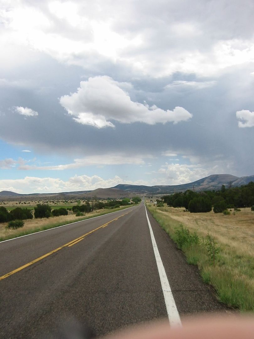
What is particularly interesting about the scenery during this entire stretch towards Eager is the transition of foliage from relatively barren land to very large Juniper trees to fairly large Pine trees all in the span of a few miles. Another noticeable difference at this altitude, aside from the lack of air, is how blue the sky appears. There seems to be very little air pollution in this part of Arizona and the altitude makes the sky appear a very deep blue. This combined with the white puffy clouds that form in the early morning make for quite a picturesque high-plains desert scene, almost post card like for sure.
Heading easterly the climbing begins with a few upward sloping rollers. Our small peloton stays together for a short while then separates into a few smaller groups with Bobbie and I staying with the front group of about 6 riders. Highway 60 is a two lane road with a relatively nice shoulder that has been ruined with ADOT’s installation of those bloody rumble strips. What we found particularly annoying about Arizona’s rumble strips was the decision to move them so far to the right of the white line. In just about all cases, ADOT placed the strips 6 to 8 inches into the shoulder leaving the cyclist with only about 12 inches of useable riding space on the outside of the road. In other cases the strips would weave unexpectedly further into the shoulder leaving only about 6 inches of useable riding space. Several times we were forced into the road to avoid riding ourselves off the right side and into a culvert. Oh well, I guess things are here to stay so we will have to adapt.
At around 35 miles or so there are more upward sloping rollers that lead to the first SAG station just outside the small town of Vernon. The Midway Station convenience store graciously hosted this stop with food and refreshments provided by the GABA support crew. At this point, the weather held out, but we could see some thunderstorms building to the southeast, threatening our near perfect ride so far. We shared some ride stories and pleasantries with some of the other riders for awhile and then topped off our water bottles for the final push into Eager. Just before leaving, we struck up a conversation with a real Arizona cowboy and his wife about the changing weather patterns he has observed in the past few years. Evidently, this part of Arizona in the past received quite a bit of snow fall in the winter months. According to the cowboy, most of that snowfall has withered off due primarily to the changing weather patterns in the area. All in all, he bid us farewell and wished us a safe and happy journey. I certainly wish all those cowboys who drive those big four-wheelers were as nice and pleasant. I found that the rudest drivers on these roads to be the good ‘ole boys who drive the big gas guzzling trucks.
On the way out of Vernon and onto “Halfway Hill” you are greeted by a very nice but short lived downhill run. After this the climbing begins in earnest. The climb isn’t really all that bad and most of the road pushes upward at 6% grade and in some spots ranges upward to 8%. About halfway up, I noticed some thunder and lightening moving its way from the south towards the summit of our climb. I figured we would probably out pace the storm but my assumption was a very poor miscalculation. Riding on ahead of Bobbie, I noticed Mr. Phoenix Athletic Club coming up along side of me on his “fixie” bike. This guy looked more like a weight lifter or wrestler than a cyclist. He was breathing very heavy and trying very hard to pass me as we matched cadence up the mountain. This guy’s calves looked like upside down bowling pins…they were that huge! Shortly before the summit, I let ‘ole bowling-pin legs have his victory while I settled into a nice casual pace for the rest of the climb. Reaching the summit at 7550 ft, this is where things started to get dark, and cold. The GABA folks were kind enough to put a water stop at the top and I noticed all the volunteers were donning rain gear one by one. About the time Bobbie rolled up, the rain started and the thunder boomed. We hung around long enough to get our vests back on and joined up with a large group from the Phoenix Metro Bike Club. Trying in vain to beat the downpour we all lined up single file and raced our way down the mountain. For about 8 miles we cruised very rapidly in a desperate attempt to ride through the storm. I find that the hardest thing to do while riding at high speed through the rain is to be able to see. Windshield wipers on my glasses would have been ideal for sure. There is just something special about breaking out of a cold driving rain storm into warm welcoming sunshine. The feeling takes me back to my childhood when on those really hot, muggy days I would jump through the sprinklers and run back out into the sun to get warm. I laughed and told Bobbie, “I feel refreshed” with a big grin on my face. She just looked back and said, “You’re crazy.”
Off to the southwest we spied another downpour moving our way. Once again, we made a vain attempt to out run the shower, so we finally gave up and just enjoyed the short but intense bath. We dried off under another welcome bit of sunlight and met up with the Phoenix riders who were stopped at an intersection to take off and stow their rain gear. For the last push of the day, we met up with another nice tandem pair and blasted the last six miles into Eagar.
Day one stats:
Distance: 63.63
Time: 3 hours, 32 minutes, 28 seconds
Average speed: 17.97
Climbing: 3,363 ft.


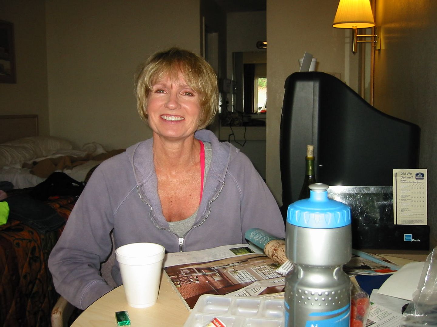
It appears that we arrived in Eager just in time because the skies opened up with a vengeance all night long and drenched the small Arizona town with thunderstorm after thunderstorm. I was almost afraid to look outside the next morning fearing we were in for a very miserable return to Hon Dah. Much to my relief, the skies the next morning appeared clear and blue with not a cloud in sight. The temperature was a refreshing 60 degrees and would remain that way well into morning hours. Satisfied with a good breakfast and all packed up, we left our humble accommodations at the Best Western and started on our return journey. The route slip was a little misleading as to the amount of climbing on this day as we were soon to find out. Basically, the route is pretty simple from here: Proceed up the street to highway 260, turn west and keep going until you hit Hon Dah! It takes about a nanosecond to be smack dab in the middle of the wide open spaces once you turn west on highway 260. Amazingly, on the north side of the road all you can see is rolling barren high desert while on the south side of the road there is juniper forest and pine trees gently rolling their way up to the mountains.
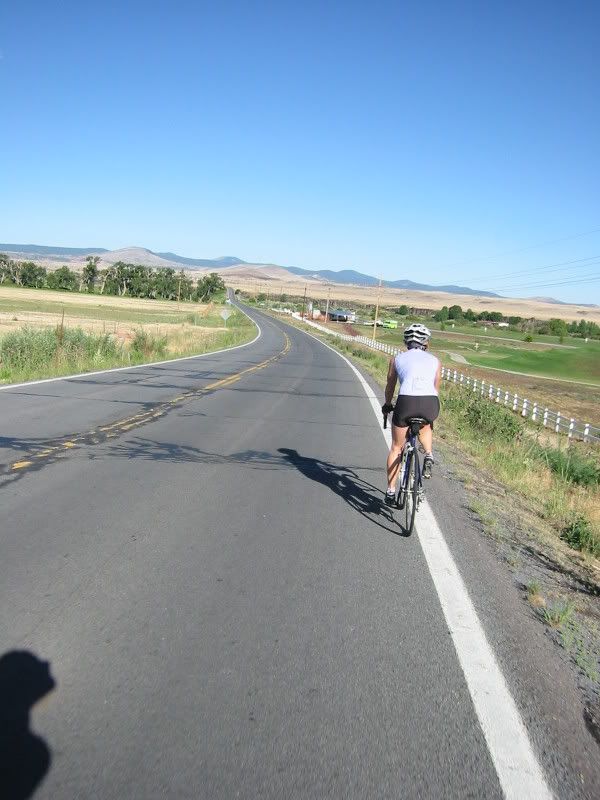
We seemed to have left at the optimum time because we came upon several other riders also starting their final push towards Hon Dah. Because the terrain is rather barren at this point you can see the road for miles ahead as it creeps slowly upward. Ten miles or so into the ride is where GABA conveniently forgets to mention the 8% to 10% climb you encounter. It is short but steep. Now, this little climb really isn’t all that bad except for the fact that you are about 8500 ft up at this point and the air is a little thin! Bobbie and I diligently motored up at 7 to 8 mph and were greeted by a nice headwind at the top. It appears that we have climbed up and onto a high-plains plateau that leads into the Apache Indian reservation. Apart from the entrance signs, you can always tell when you enter the reservation, there are no buildings and no sprawl of any kind, just unspoiled wide open scenery…the way it is supposed to be. The terrain and foliage change dramatically up here, gone are the juniper trees; replaced by tall pines lining the road on each side ahead. About 14 miles into the route, GABA positioned a SAG stop and it couldn’t have come at a better time. Gone was the fuel from breakfast and we both needed to rest the legs a bit after a big day yesterday. We struck up a great conversation with two ladies who flew all the way from Australia to do this ride. They were both riding Bike Fridays and it was fun to talk bike setup, gearing and tires. Apparently, they were familiar with the routing because they told us that we had one last butt kicker of climb ahead. With that, we bode farewell to our new found friends and pressed further into the forest. Yep, they were right. There is was, a 6% climb meandering its way up and into even more dense forest. About 45 minutes later the road leveled off and emptied out onto yet another plateau, and we could see several ski runs off into the distance to the southwest of our route. We had finally reached the summit of our journey for the day and it was nice to get back up to cruise speed. We formed a nice little peloton of about 4 riders and stuck with them to an unexpected SAG stop situated at the start of our final descent back to Hon Dah. This stop proved to be rather popular with the crowd as it appeared that everyone who started before us and a few who arrived after us stopped in for some much need refueling. It was also nice that the forest service put nice toilet facilities out here in the middle of no where!
The final segment of the tour from here is mostly downhill with a few short rollers thrown in just to keep you honest. Again, the route ducks into the forest and stays that way all the way back to Hon Dah. After all that climbing, the bomber downhill runs were a nice respite. Even at this altitude, we hit 30+ mph with little or no effort all the way back. Hon Dah Casino seems out of place as it just pops out of the forest all of a sudden. We rolled into the back parking lot without a hitch, parked the bikes and picked up our luggage at the appointed drop-off point. Shortly after our return, the original tandem couple who we tagged up with at the beginning of the ride rolled up along side our car. We talked for quite awhile about other rides GABA puts on and it was nice to make some new riding friends. All in all, this was a great ride and fun event. One we will do again next year for sure.
You can see more pictures here
Day two stats:
Distance: 39.59
2 hours, 39 minutes, 09 seconds
Average speed: 14.93
Climbing: 2,497 ft
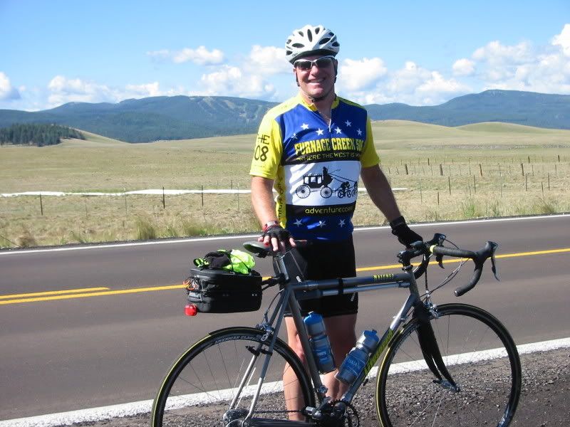
Kent and Bobbie Costin
No comments:
Post a Comment